
Geophysical Survey
Seismic Refraction
Determining the elastic parameters of the ground (poisson's ratio, modulus of elasticity, density, etc.) It is the most known and used geophysical method used in the detection of gaps in it and many similar researches.
Seismic Reflection:
It is a geophysical method used in oil and natural gas research, determination of coal deposits, analysis of submarine grounds, and earth crust research.
This method, which reveals the resistivity change as the depth progresses downward over a single point above the ground, provides correlation with the geological information at the relevant depth. It is a widely used geophysical method in groundwater exploration.
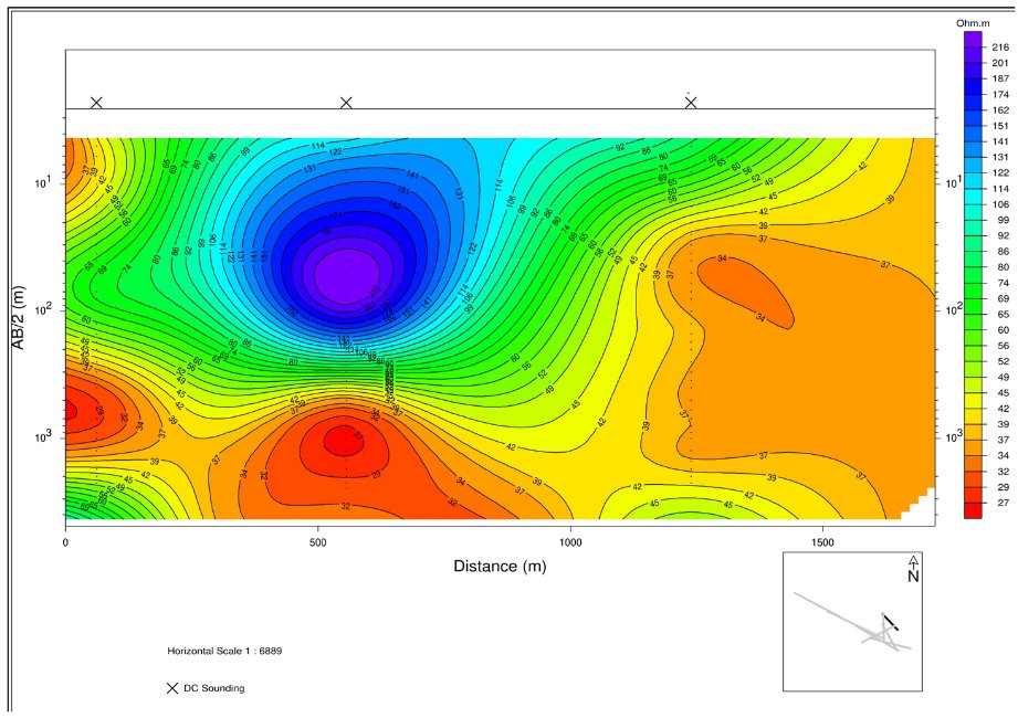
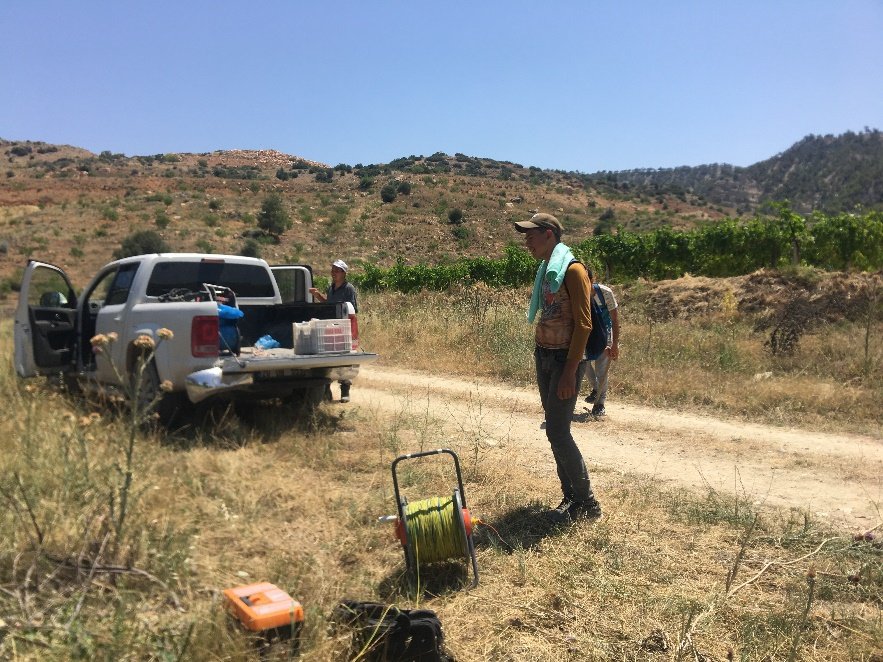
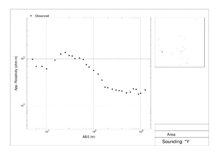
DES FIELD WORK AND SAMPLE PROFILE SECTION EXTRACTED FROM THE WORK - CURVE AND 3D DIAGRAM
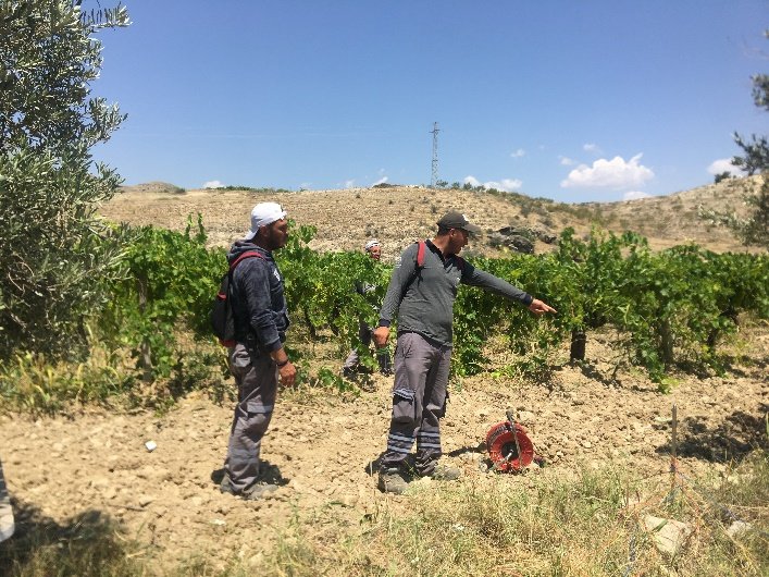
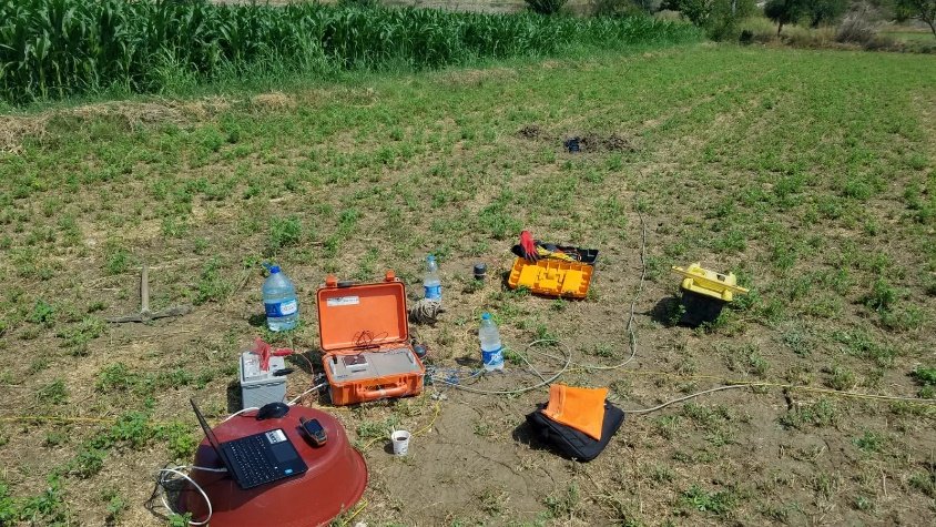
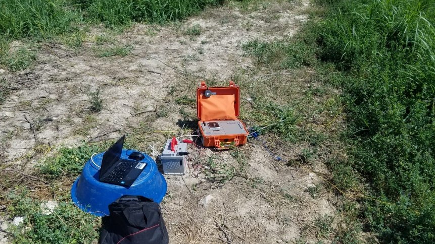
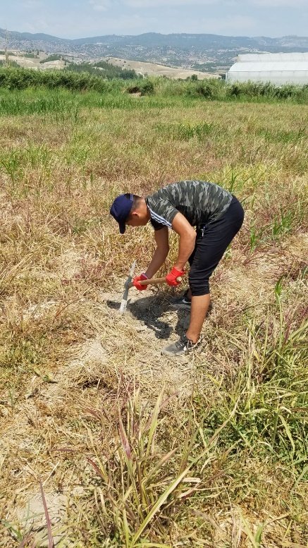
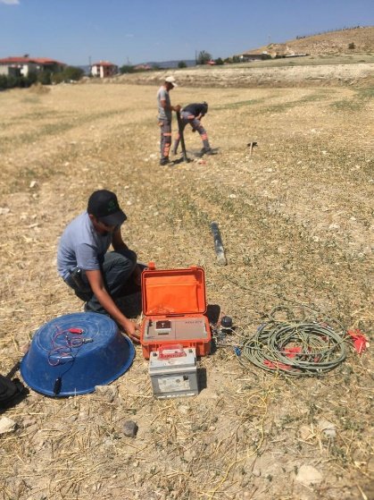
It is a geophysical method that enables to reveal the geological structure by using the horizontal and vertical electrical conductivity differences of rocks. This method is used in groundwater and geothermal energy exploration, mineral exploration, archaeological exploration and oil exploration.
It is a geophysical method based on the principle that it varies according to geological units and gives the change of the potential difference that occurs after the current is applied underground for a certain period of time. It is the method generally used in sulfur mine exploration.
Its basic principle is to Work the changes in the magnetic field of the earth. As a result of the concentration of magnetic minerals underground, magnetic anomalies are seen and thanks to these anomalies, valuable ore and ore deposits with magnetic properties are formed by magnetic minerals gathered together.
Except for earthquakes and seismic explosions, it is the general name for vibrational movements that occur due to natural and unnatural reasons and whose periods do not exceed a few seconds. It is used to determine the soil type and stratification.
It is a geophysical method that works with the high frequency electromagnetic principle used for close surface investigations. It is a highly accurate method in the analysis of foundations, ceilings, columns, beams, concrete and reinforcement of buildings, archeogeophysical Works and gap detection.
It is the method used to determine structures with different densities under the ground by using gravity acceleration. This system is used in oil exploration to determine the location and thickness of the salt dome, to investigate the crustal thickness, to investigate mineral deposits, to monitor fault systems and volcanoes.
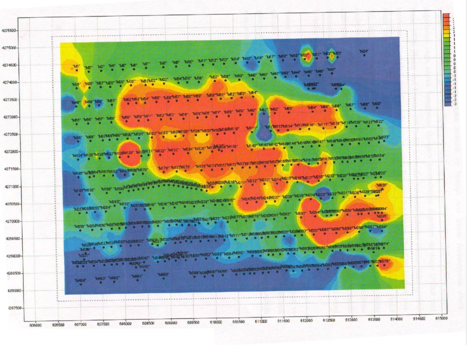
GRAVITY BASE POINT - RESIDUAL GRAVITY MAP
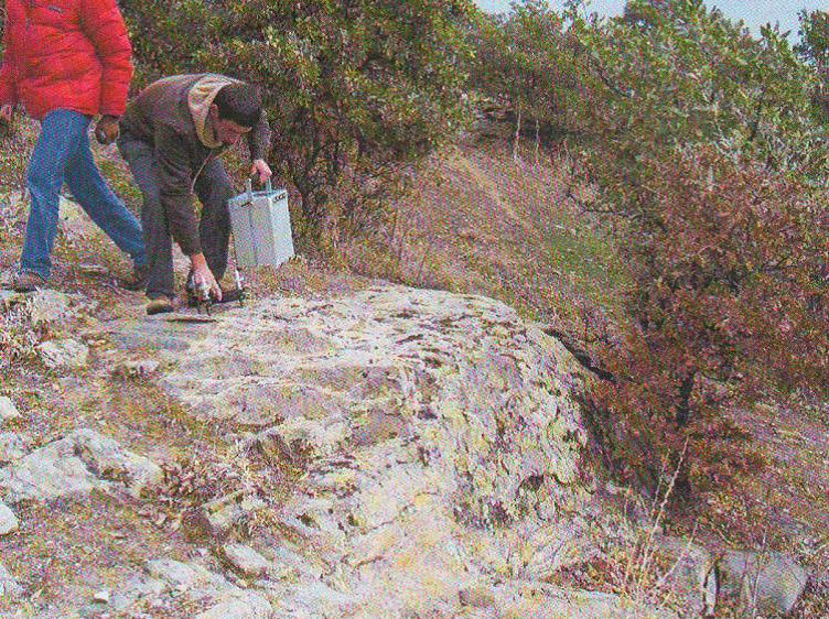
Electromagnetic (EM) induction methods are carried out either by making use of the changes in the magnetic field of the earth or by applying an electromagnetic field into the ground through a dipole. Magnetotelluric (MT) and Geomagnetic Depth Drilling (GDS) are naturally sourced methods that exploit changes in the earth's magnetic field.
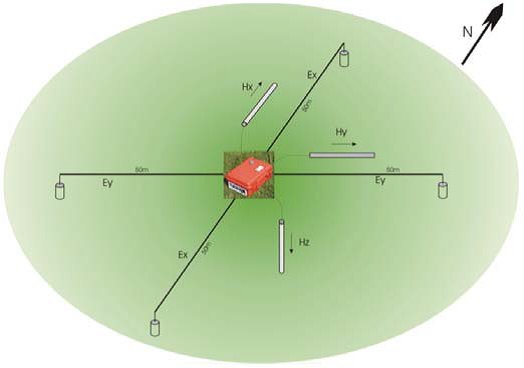
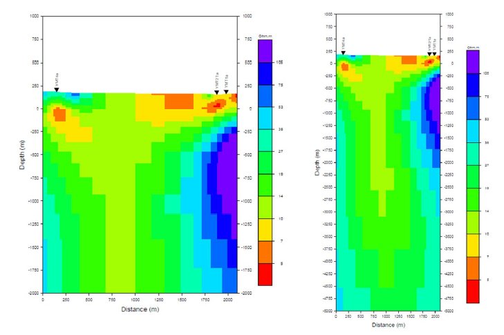
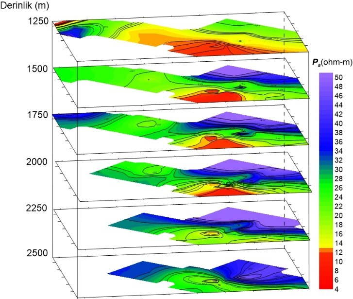
MT FIELD WORK AND EXTRACTED SAMPLE 2-B INVERSE SOLUTION
About us
Ark mars enerji̇, it is a consultancy firm that closely follows the technological developments and provides services with its expert technical team in the field of engineering by producing a reliable, result-oriented solution in all demands and projects with the right engineering approach and correct projecting in design and applications.
8161. Sokak No: 4/3 Çiğli/İzmir
+90 554 636 13 08
info@arkmarsenerji.com
ARK MARS ENERJİ ENGINEERING DRILLING PROJECT CONSULTANCY SERVICES
© Ark Mars Enerji, All Right Reserved.
Created By TitanSoft